 Custom Search
We're the second car to arrive at the walk start,but plenty more pull in behind us for a well attended walk.
 There's hardly a cloud in the sky as twenty three of us set out.
 Ahead is the outpoint of todays walk-The Mull of Galloway Lighthouse.Farm track and fields take us over to the coastline.The Ramblers have had quite a few walks at this end of the Rhins and this is the first one i've managed to attend,so i'm really looking forward to it.
 This is a very rugged coastline.It's an area of rocky outcrops,roman hill forts,caves and nature at it's best.It wasn't long before a peregrine falcon was spotted.We're zig zagging in and out of funny shaped knowes and knolls(or is a knowe a knoll anyway,i can never remember)
This is from the Mulls own website.
The Romans
Agricola looked across the North Channel to Ireland, which could be conquered and held, he thought, by a single legion of his regular troops supported by auxiliaries. The Roman hold on Britain would then be much stronger.
Agricola's dream came to nothing. He was recalled to Rome in 84. But he was right when he saw the strategic link between the Rhins and Ireland - a link which remains significant throughout the later history of the area. Some of the evidence for later developments is to be found in local place-names.
In Agricola's time, the people were Britons, speaking an older form of Welsh. In the South Rhins they are commemorated by the name of a farm, Drumbreddan (bold type indicates a place in the Southern Rhins), 'the ridge of the Britons.' Their chieftains lived in hill-forts, like that of Dunman, 'fort of gables,' 400 feet above sea level; some in drystone brochs, like that at Ardwell Bay. They built substantial fortifications, like the one between East and West Tarbet, which defends the Mull of Galloway against marauders from the north.
Probably before the end of the Roman period farmers and fishermen from Ireland arrived in the Rhins. Their language was an early form of Gaelic, which was to become the staple language of the countryside for the next twelve hundred years.
 Beneath us here are Belloue and Carrickgill caves.
 The track takes us down to a point close to the shore...
  ...where we take a break to enjoy the views....and have a natter of course.
 Now we head into the Mull Glen and follow the burn back inland.There's a Kings Well on the map at this point.It's possible our walk leader pointed it out,but with me being towards the rear i probably missed it.
 We're climbing out of the glen now.
 Here we overlook West Tarbet Bay.I've never figured out what this tube is,and i've never got round to asking anyone.I'm not sure whether there's a door on one end.It would make a good shelter i suppose.
  Now we reach the road up to the Lighthouse,we'll follow this up to the top.
 The narrowest part of the South Rhins is where we joined the road between east and west Tarbet.It's almost like an island at the end where the land mass sharply veers east to west.Below us here is the pinaccle known as Gallie Craig.This is Scotlands most southerly point.It is further south than the english cities of Carlisle and Durham.
  Now we reach the Gallie Craig restaurant and the entrance to the lighthouse complex.One or two ramblers who know the reserve like the back of their hands decide to partake of the beverages offered by the cafe...
  ...while the rest of us head over to the visitors centre.This is an RSPB reserve and most ardent bird watchers know of it's existence.They have their own website at
Mull of Galloway
A 'Spotted Today' board inside the visitor centre already had a Peregrine Falcon up,and to the chagrin of our member(Slewtrain) who spotted it,the Stonechat was there too.
While a couple of walkers climbed down to inspect the foghorn...
 ...the rest continued around the lighthouse...
 ...to regroup at the cafe.
 We're heading along the southern and western edge towards...
  ...Gallie Craig.I wonder if there's a way down to the pinnacle?.The weather's still fabulous.
 Behind us the headland of the Mull,with the waves crashing into it's seacaves is a picture postcard view today.
  North of Carrickcorie now i get myself in the picture.Well reflectively anyway!
 Now we head to the centre point of our figure of eight(that's a long pair of arms being held aloft there)...
 ...and overlook East Tarbet Bay.
As we head north,the path now becomes a bit more more difficult.It's more used to sheep than humans i think.
 Just after spotting these shags enjoying the sun,we saw them take off-a fishing boat was getting a little too close to them.
 Finally in this secluded cove we rest for lunch.There's several small bays up this eastern stretch,and until i see the walk leaders report,i won't hazard a guess on naming it,suffice to say it was sheltered from the wind and welcome.
 Lunch over and we're starting the last stretch.We head back inland and up the nicely wooded Cairngaan and Auchie Glens.
 Reaching the tarmac in time to see this boat go past.We're not taking the direct route along the tarmac road.We're rounding a couple of small hills going by the name of Slewmag and Biangens.
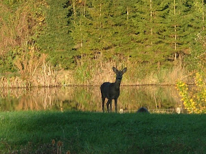
 It's a couple of fields were crossing.These two soon scarpered once they realised we were coming their way.
 We pass farms with names like Pulinkum and Muntloch.There's a lot of mud picked up on boots as we emerge at Cardrain.From here it's a short walk along the road back to the walk start at West Cairngaan...
 ...where to complete a really lovely day...
 ...we're treated to tea,cakes and all sorts of delights in a real farmhouse kitchen.
What a great way to end a walk.
A very enjoyable day,even more so since the rains coming back with a vengeance.


Magnificent part of the country.I haven`t been there for about 10 years and must get back.I usually camped in West Tarbert bay and would watch the streetlights twinkle over in Antrim as I enjoyed a bottle of rouge outside the tent :-)
ReplyDeleteNice spot of weather you had for it as well..!
Hi there, now those are views i am oh so familiar with, my mum & Dad own the very last cottage before the farm on the walk to the lighthouse, they renovated it, it was a complete ruin! so we have spent many, mnay happy hours walking there. I think the drum on the shore was an old container from a ship that was washed ashore many years ago. thank you for the loreena link. Yep im finally recovered from that strange bug. *ruthie*
ReplyDelete