
 Custom Search
I fancy a wee coastal walk,so i'm heading north of Cairnryan to Finnarts Bay.
 After parking by the disused fish factory, I head round the shore at Garry Point.Looking back to this bridge over the Water of App,it's probably the original road over,but perhaps not the original bridge. Historically bridges in South West Scotland were never built to survive the onslaught of flooding after days of torrential rain.A regular occurrence around these parts.
  It's a rocky rugged terrain,but high enough up are sheep and animal tracks to follow.Here's Galloways very own version of Antrims 'Carrick A Rede' rope bridge.The cave underneath looks like it goes in a long way,but looks totally inaccessible.
 Apparently this stretch is popular with cliff edge climbers.It's easy to see why.I keep an eye on the waters edge,there's many a shipwreck along here.Not much chance of spotting anything today though.There's lots of seabirds about though.
 The highest hump ahead is my target today.That's Finnarts Hill.There's a Nelsons Cove along here.
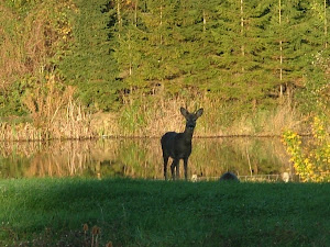
 Goatspeak interpretation."We dont get many two leggers along here"
 A perfect location for a pair of ravens.They'd been broadcasting my approach for quite a while,and after a couple of sorties overhead,I had visions of being dive bombed.My fears were unfounded though,and I stayed upright.
  I managed a few silhouettes of them.
  I'm opposite Milleurs Point on the North Rhins here.Although I've taken countless pictures in the past of Loch Ryans ferries,I can never allow one to pass without snapping it.
 After disturbing a few woolly creatures I'm atop Finnarts Hill.The furthest i can see today is a hazy look at Ailsa Craig.The sky's still heavy with cloud.
  It's not much better to the south.I can see the work on the new ferry terminal is fairly moving along.I'll be heading back down via that isolated structure on Garry Hill.
  It's obviously a remnant from WW2.A perfect spot for a lookout.Not of a regular pillbox design though,it's got an upstairs!
  I head down to cross the humpbacked bridge back to the car.A swampy marshy pond exudes colour.
 This view of Sandloch Hill brings todays damp walk to an end.
It's been wet but enjoyable.


No comments:
Post a Comment
Thanks for all your comments. I may not get to reply to them all, but you may be sure they'll be appreciated.