 Custom Search
Saturday the 11th January 2014
I don't know if it's another bug I've picked up, but I've been suffering with an upset tummy for a couple of days. Hopefully today's good long walk will help.
We're walking a section of the SUW (Southern Upland Way) from Stranraer to Portpatrick.
This is a walk we do quite regularly (or the other way round)
Shorty is writing today's report and I'll publish it when I get it.

Twenty three of us set out from Stranraer on a nice bright crisp morning. This will go up to 24 when another walker joins us at the lighthouse.

We're soon up Gallow's Hill and a view up Loch Ryan and Ailsa Craig. There's a local saying apparently, it's "If you can see Ailsa Craig it's going to rain, if you can't see it it's raining"

A bit of road walking takes us up beyond the old Hillside Piggeries past Greenfield and Little Mark.

There's a view back to Artfield Fell Windfarm. If all those proposed are granted planning permission, all the surrounding hills will be full of turbines too. Too many !

The view across to Cairnryan gives way to a view of Knockquhassan Reservoir.

Here we leave tarmac and take to the moors.

It's a bit squelchy in places, but nowhere near as bad as I'd expected.

There's an occasional stop to let backmarkers catch up and for the distribution of sweets.

Of the bottom two turbines only the right one was turning. On the way home we saw lot's of turbines not moving. I guess it's been too windy for them !
(I'm not anti windfarm, but enough is enough when they need subsidies to keep them generating electricity)

The project is coming to an end so if you got yourself a 'Merk', hang on to it. They're still stocking the 'Kists' till they run out of the stock they have, but will not be minting anymore.

Mulloch Hill

Back on to hard standing at Glenstockadale Several

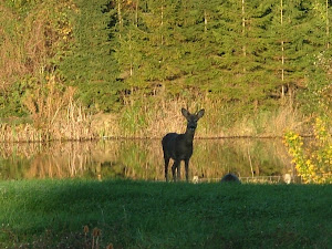
The red deer sign is new.

It's downhill after this brae

In our first view of the North Channel we see one of the regular ferries crossing between Loch Ryan and Northern Ireland.

This is the 'Honda Kid' and a donkey.

We've a colourful set of walkers today.

Killantringan Lighthouse comes into view.
It's for sale if any reader is interested. Half a million will get you it.

The hump to the left is where we'll have lunch.

This is what's left of the Craigantlet.
In all my pictures of the wreck, this one show's the most.

Now we'll follow the shore path south.

The lighthouse remains in a rear view for quite a way.

There are still a few ups and downs.

The route takes us down Portavaddie up March Howe and over Ouchtriemakain Moor

The steep descent to Port Kale and Lairds Bay

Lairds Bay.
Once a cable hut for Electricity to Donaghadee then a coastal interpretation station now disused.

Brixham is in Devon, looks like this fish box has travelled.

From Lairds Bay we round the headland to Port Mora and Sandeel Bay.
While searching for a particular item on Sandeel (Sand Eel) Bay, I came across an interesting publication.
Searching further I see there's a whole Set of these publications. Remember the days when you'd spend hours researching in a library..........a click of the mouse is all that's needed now. That's progress, but it probably takes the fun out of the task.

Portpatrick in sight. I learned today that the mast and hut to the right has been sold and the buyer wants to build a residence on the site. Seems he/she is meeting some opposition.

The last leg down to the harbour.

The Crown hotel was the venue for after walks refreshments. My driver, myself and his other passenger decided we'd sooner catch the earlier bus, so we probably missed out on some excellent fare.
It was a grand walk though.
Back home after tea I couldn't move. An early bed was the refreshment I needed.
Shorty's report will appear here.
Wigtownshire Ramblers – Saturday 11 January 2014 – Stranraer – Portpatrick
Wigtownshire Ramblers – Saturday 11 January 2014 – Stranraer – Portpatrick
Saturday was a beautifully clear and sunny day with a brisk breeze which kept the temperature hovering just above zero. Twenty three ramblers assembled at the Breastworks car park. We soon set off across the road and up the Back Rampart. A good pace was maintained through the town and up the hill towards the new Gallowhill Woods, passing the much improved playing fields and the cemetery as we climbed. The views back over Stranraer and up the loch towards Ailsa Craig were breath-taking, or maybe that was just the steep slope!
We followed the road past the old piggeries where the small wind turbine rattled alarmingly in the brisk breeze. From here we followed the Southern Upland Way (SUW) down the road to the Piltanton Burn and over the hill to the Crailloch Burn where the effects of the recent extreme weather were evident in new landslips where the high water had undercut the banks. From the burn a steady climb took us to Knockquhassen and the reservoir which was full to the lip. The SUW leaves the road here and follows a narrow path over the bogs and hillocks along the south shore of the loch. On previous visits we had found this section almost impassable due to deep mud and water but things have now improved considerably and only one short section needed to be by-passed.
When we reached the green field of Mulloch Hill we found the Makar’s Kist with its supply of specially minted medallions or “merks”. This is one of thirteen kists hidden along the length of the SUW. Unfortunately the project has finished and no new merks are being minted. The supply is limited and will run out soon.
A short climb took us to the top of Mulloch Hill, the highest point on today’s walk. There are fine views in all directions; eastwards to the Galloway Hills and westwards to the North Channel and the Irish coast. Descending the hill we reached a rough track which lead back to the county road through Glenstockadale. The map makers seemed to have run out of names in this area. Old maps show two adjacent farms called “Glenstockadale Several” and at least five called “Knock and Maize”. The latter name probably derives from the Gaelic for rocky and boggy, an excellent description of the area. Many of the properties have been rebuilt recently and new, less confusing names have been applied.
The route was now mostly downhill and we stepped out briskly down the road to Killantringan lighthouse. Here we stopped for lunch and took refuge from the cold wind behind a low ridge above the remains of the Craigantlet. All that was visible of the wreck was a small section of the bow. This was somewhat further out than we remembered. All sight of this wreck will soon be lost.
After lunch we followed the path along the cliffs. There were several steep descents and climbs, especially down the almost vertical steps to Port Kale. This is also known as Laird’s Bay and was the site of the mainland landing for the first successful underwater telegraph cable to Northern Ireland. This has now disappeared but the stone huts which housed the equipment still stand, having been used in later years as a visitor centre. It is now, unfortunately, boarded up.
A short path from Port Kale took us into Port Mora. The rubbish washed up along the shores is disappointing. Much of it seems to wash across from the Irish coast but some from much further afield. One fish box displayed an address in Brixham in South Devon.
After a final climb alongside Dunskey golf course we reached the old telephone radio mast and the steps down into Portpatrick. We were welcomed at the Crown Hotel for tea and scones in spite of our windblown and mud spattered appearance. The sun was rapidly descending towards the Irish coast and the breeze was getting cooler as we waited for the bus back to Stranraer.
Next week’s walk is another 9 mile linear walk, from Wigtown to Newton Stewart. Meet at the Breastworks Car Park in Stranraer to share transport or at 09:45 in the Riverside Car Park in Newton Stewart to catch the 10:00 bus to Wigtown. New walkers are always welcome, but please contact the walk leader on 01671 401222 for further details.


Brilliant series of photos. I feel as though I took this walk myself. I smiled when I saw the donkey...I love donkeys. :)
ReplyDeleteI've walked some of that route a few years ago and really enjoyed it.Hope you tummy bug clears up Jim, I swear by a couple of peppermint Rennies going to bed.
ReplyDeleteI love Kilantringan light and bay. Sure I left half a million down the side of the sofa...
ReplyDeleteI might get some Donkey pictures on my next walk Linda, saw some on the recce.
ReplyDeleteI know what the problem is Bob. Having IBS it'll occasional flare up, I tend to forget and drift away from a high fibre diet. After getting back to Bran, Baked Potato, Broccoli, Wholemeal, Brown Rice and Fruit and Veg I'll be fine.
I guess the half million didn't turn up Robert, I see it's still for sale.