Clicking a picture will bring up all the posts pictures in a slideshow. To view an individual picture in full screen, right click and select 'Open link in new tab'

Tuesday 30 December 2008

Family visitors.

These lovely folk made the long run up to Galloway to visit this old blogger before the year end.
(Click to enlarge)
Thanks guys,it was great to see you.

Sunday 28 December 2008

Wigtownshire Ramblers-Stranraer to Loch Magillie

It's Sunday the 28th of December 2008.Todays walk is the last Ramblers walk of the year.It's on the programme as a circular to ' Walk of the Plum Duff 'and takes in a stretch of the Southern Upland Way.
We're a group of eleven today,and we're starting from the dead centre of Stranraer (well the Glebe Cemetery anyway.ha ha)in a south westerly direction.

There's no difficult climbing today,so i'd hoped i'd have no leg trouble today.As it was i did have a bit of bother,but walked it off.The first part of the walk takes us up Gallow Hill.Presumably this was where they hung the sheep stealers and other felons.

We're soon high enough to get a great view up Loch Ryan with Ailsa Craig plumb centre.Continuing on past Hillside Piggery,this is where we join the route of the Southern Upland Way,with a directional change to south easterly.

The local constabulary were following up a report about a group of suspicious looking characters on the roads,but decided we were harmless.(I made that bit up.......about us being harmless that is.)

Now up at Ochtrelure and Ailsa Craig's gone and moved and the Stena HSS is on the way in.

High hedges for the next kilometre or so,and folks were catching up on what their fellow ramblers had been up to at Christmas.

Now over at Spout Wells we deviate a little off the Southern Upland Way and take a short cut.

This is due to the late start and the early sunsets at this time of the year.We're heading in a north easterly direction now.

The absence of photographs over the next few kilometres is due to the fact that the only views worth taking were to the south,directly into a bright sun.
We passed a burn by the name of Black Stank and woods known as Guyon's Brae and Barrack Hill on this stretch.Pleasant enough anyway.

Now at this junction,we're at the outward limit (No mate! not the Outer Limits.I know we get up to some funny things but we're not that bad) of todays walk.

We take a break for a natter and a cuppa here.I take this picture of Loch Magillie through the hedge...

...and a group photo before starting back.

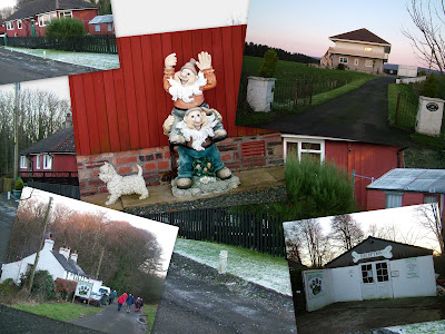
We're heading north west on the old military road now.It takes us through Lime Kiln,Two Mile Howe and passed Rhodora Villa.Here's a collage of some of the interesting parts.

Now as we head up the Black Parks Industrial Estate road,the sun's getting lower.I should do another sunsets project,we get some beautiful ones all over Galloway.

Now we're at the end of the walk at the Black Parks Factory shops.(The Galloway Tea rooms here are to be recommended)
I have time to finish my coffee as the drivers are ferried to the cemetery (To get the cars,silly!).
A nice way to spend a Sunday afternoon between Christmas and New Year.Frosty,fine and good company.Lovely.

P.S
Here's an alternative view of Stranraer.

Thursday 25 December 2008

Merry Christmas Everybody


Wednesday 24 December 2008

Alternative views of Galloway

A while back i posted an alternative view of the Galloway Hills by compressing a panoramic picture.
Here's a few more of a different perspective.
Opposite Bennan Hill on the Glentrool to Straiton Road.

The western side of Newton Stewart from above Barbuchany.

Black Water of Dee below Clatteringshaws Dam.

The Cree Valley from the woods over Barrhill Farm.

Drigmorn from Auchinleck.

Climbing down alongside the Grey Mares Tail Burn opposite Craignelder.

Another view from the Glentrool to Straiton Road.

Kirkdale Mains Farm.

Currarie Port near Ballantrae.

Newton Stewart from Barrhill Farm Woods.

Another view of the Black Water of Dee below Clatteringshaws Dam.

Saturday 20 December 2008

Wigtownshire Ramblers-Palnure to Creetown

It's Saturday the 20th of December 2008.
Today's walk is one of the shortest and easiest ones on the programme.It's from Palnure to Creetown returning the same route.

Sixteen of us meet up at the Cairnsmore Hill Climb car park.
Heading south from the Graddoch Bridge we follow the Old Military road.This is a tarred track-it's part of the 7 Stanes cycle routes-so it's hard underfoot.We head past Cuil and Blairs Woods,with open views over the Cree valley.My right leg decides to play me up today.
Most of the way we can see the traffic on the A75 euro route.I'd like a £ for every McBurney lorry i've seen along here.It's overcast today and there's rain forecast for later,but it's dry at the moment.There's quite a variety of cattle today.There's Royal Bank of Scotland waymarkers along here,I think i've mentioned these waymarkers before.(There's no truth in the rumour that they intend to collect all their waymarkers and smelt them down to raise capital).
We reach the old A75 into Creetown.A few hundred yards along we're heading past these very excitable water buffalo.Our timing couldn't be better as the farmer feeds them.He's keeping them in the pen while we walk through the field beyond.These belong to the Barholm Mains Open farm,which has a wide variety of animals and is open to the public.
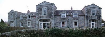
Now we reach Barholm Mains.It's a nice wee house.
Once through the Barholm estate,we're into Creetown.

For a small place Creetown has a lot going for it.It has a well established annual country music festival.Creetown Country Music Festival
Some wonderful walks and woodlands.Creetown Walks
And where we're heading is the Prospectors Pantry Cafe,part of the Gem Rock Museum
Most of the ramblers took advantage of the delicacies on offer here.I really must have a look in the museum sometime.We had a nice long lunch break today.All good things must come to an end though,and it was soon time to retrace our steps.
Back on the road this was where a horse watering trough was located.The sign says 'A righteous man regardeth the life of his beast.Prov.12.10'
It's raining by the time we're back at Graddoch Bridge.I'd walked of my painful calf muscle,but wouldn't you believe it,it's back for the last stretch.I needed the walk though,and i'll do this one again in the sunshine.

Thursday 18 December 2008

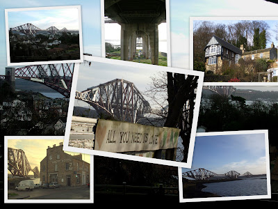
North Queensferry and the Forth Bridges.


Tuesday and Wednesday of this week i had occasion to go over to Fife and Edinburgh.
This time i took a longer look around North Queensferry.

These are just a few of the pictures i took.
I took this panorama from Carlingnose Point Nature Reserve.The Fife Coastal path stretches for 150 Kilometres and begins here.
Fife Coastal Path

Panorama of The Forth Bridge on CleVR.com


Deep Sea World is situated here,I'll have to visit sometime.
Deep Sea World

It had become squally and overcast when i arrived back at the harbour,but still managed this panorama of the road bridge.Looking at the two bridges there's no doubt which one wears the crown.Lets hope it'll always be there.

Sunday 14 December 2008

Wigtownshire Ramblers-Ardwell

Saturday the 13 of December 2008,there's been a lot of overnight rain.
We,the walkers meeting up at Newton Stewart Riverside carpark,decided that Somerfields car park was a better option today.

We're a total of 21 walkers today,and todays walk will take us to the west coastline of the South Rhins.

Our first stop though is a little further inland where we meet up to view the Kirkmadrine Stones.


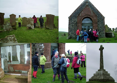
The Kirkmadrine Stones stones sit in the previous entrance to the now disused Kirkmadrine Church. The church sits on a small hill with an open outlook.The stones are behind glass for protection to the stones and photographs have to be taken through the glass.
The stones are thought to be the earliest examples of Christian carvings in Scotland except for those found at Whithorn. The crosses have examples of the Chi-Rho carving of early Christianity. This is the monogram of X and P denoting the first two letters of the word "Christos" in Greek, meaning Christ.
Our walk today is in three sections,so now we pile back into the cars and head west.
This is geese migration season,and this was the tail end of of a much bigger flock.

Our next stop is here at Cairngarroch bay.This was the scene of a world war two disaster when a US Dakota Air Ambulance crashed into the cliffs above.I blogged a previous visit here,and anyone interested in seeing more pictures can click here.Cairngarroch Bay

The original plan was to head south on the coastal path from here,but our walk leader found it impassable on the recce.The change of plans mean we now head back to the cars and move to our next starting point.
A short car journey brings us to Little Float farm,where we park up.

It's a short walk from the farm to Float Bay.Here we'll take our lunch.

No doubt this is someones holiday home.What a beautiful setting.If the owners happen upon this page,we didn't disturb anything i promise.

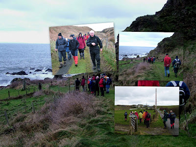
After lunch our route along the rocky shoreline had to be carefully tread.This was one of two burns that had to be crossed.

Luckily the electric fences were turned off.

This seal kept popping his head up to see what we were up to.

Somewhere around a place known as Arthurs Slunk we had to scramble up from the shore.It was a grassy bank,but nearly vertical in places.
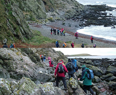
Now above the cliffs we had a lovely view back to Float Bay and what is probably Water Cave.It looks as though it would need to be explored at low tide.

After a lovely view over to Ardwell point (I need to explore this headland and see Doon Broch) we head inland again.

Here we're approaching Kenmuir.Thirty three thousand hits for Kenmuir on Google.

Time for another break,and the distribution of sweeties.

Now we're heading back to the shore.

The name here relates to an age gone by.There's another Saltpans Bay north of Killantringan Lighthouse,mentioned in a previous blog.

Another rocky shoreline,but this one isn't so far...

...we're soon walking on sand...

...this is Ardwell Bay we're entering.We take another break here.

It's only a short walk from here to High Ardwell where we'll wait for the cars to be ferried back.Our walk leader lives here,and provides welcome hot drinks and scones to those who want and need them.I did.
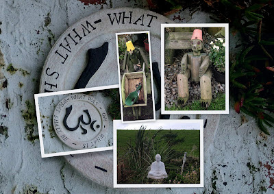
With the added bonus of tea and scones this was another thoroughly enjoyable walk.
Related Posts Plugin for WordPress, Blogger...

Photographs

Creative Commons License
This work is licenced under a Creative Commons Licence.

Morning deer

Morning deer
is someone watching me