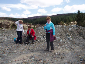
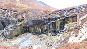
It's Friday the 24th of May, our penultimate day in the Mountains of Mourne in the County of Down.
After dancing in the foyer of the music venue last night we're up for the big one.
Well some of us are. The 'Weaver's' dodgy knee wouldn't get her up there and she's another three volunteers to keep her company. Those four will be heading over to Rostrevor to walk in the Rostrevor Oakwood Nature Reserve
With a much better weather forecast than yesterday, eight of us will head off to Newcastle to climb Slieve Donard, At 850M, It's seven metres higher than our Merrick.
We're not going up and back the same route as WalkNI show here.
Instead we'll make it a linear to finish at Bloody Bridge.
After dropping off my car at the finish we head into Newcastle and locate the Donard car park.
We're soon on our way following the scenic Glen River
We've five bridges to cross before we're out of the forest.
There are lots of fabulous waterfalls
Very nice !
We're a happy group today
We're soon gaining height.
The Ice House, a 19th century stone structure used to keep meat cold for the Annesly family, the local landowners.
"Head on up to the saddle" we've been told a couple of times....
...........it looks more like a sheer drop from here.
A heron flies overhead
Fantastic views back to the coast.
We get to the saddle, it looks just like a concrete staircase
A moments rest at the Mourne Wall. That looks a steep climb !
We're all still smiling.
On the right in the picture above is Slieve Commedagh the second highest of the Mourne Mountains.
The higher we get the more peaks come into view.
We get a little stretched out but the summit soon comes into view.
There's three memorial plaques to Carl Stephenson, the victim of a lightening strike.
At the summit there's a small shelter topped with the Trig Point which looks in need of repair.
The trig point is complete with Flush Bracket 3087
I've a feeling that the 'Tresspassers Prosecuted' sign no longer applies.
The Mourne wall at this point makes a 90 degree turn to the south.
We have lunch, trouble is it's quite windy so we don't tarry.
A few photo calls...................
...................and a wave bye bye
We begin our descent. If we'd known how sheltered and out of the wind we'd be around twenty metres lower we'd have had a more enjoyable lunch stop.
Why can't retrospect be available beforehand ?
View to the South and West.
See this view on Panogio
The views are absolutely beautiful.
Meanwhile over at Rostrevor.
If I get anymore pictures from the other group I'll put them in.
Here's a couple more.
Thanks to the Rostrevor trippers for the above pictures.
Here's a couple more.
Thanks to the Rostrevor trippers for the above pictures.
For us it's a very careful descent
Once we reach the Brandy Pad the going gets easier.
A good way down we come to this abandoned quarry at Crannoge.
There's a very comprehensive P.D.F covering the Archaeology of Slieve Donard
It's not showing up in this picture, but there was a small waterfall flowing over the 90 degree corner.
After a very refreshing moment with my head under it, my hair stood up straight for the rest of the walk.
While some of us explored........................
........................others cooled their feet. This was as close the 'Musician' came to her favourite pastime of wild swimming.
A paved road led to the outlets of the chutes.
Back on the move and we see this interesting rail line.
Here's a description I found about this by a Geographer known as Saxon.
“The railway was a 3ft gauge incline railway working on the three-rail principle. Laden wagons descending provided the force to haul the empties up the steep slope.
The centre rail was common to both and at half way or passing places the rails opened out to form two independent passing loops (similar to those on a conventional single-track railway), each with their own rails. After the wagons had crossed they resumed the journey using the common middle rail.
Some inclines were double track but it was usual, over longer distances, to operate on the three rail principle.
The “locomotive” was normally a big wooden drum sited in a building (usually roofed over the drum). The “driver” stood on the edge of the descent for a better view. He operated a hand brake on the drum to control the speed of decent.
The rope (or wire) was attached to one or more wagons at a length that allowed the wagons to pass at the loop. Normally the wagons were attached to the rope with a sprag (a one-way freewheel clutch). The rope was endless and was marked showing where sprags were to be fitted.
Without sprags the ascending and descending wagons would collide. On long inclines (and this is one of the longest I have ever seen) there would be an escape into a pit (drag) so that if the rope broke or the load ran away a catch point could be operated to derail the wagon”.
It looks an easy passage from here now. It would have been if we'd followed the road down, but being intrepid walkers we followed the Bloody Bridge river which was a little more challenging.
There's no link between the two pictures in the above collage !
Now the terrain is more friendly.
We know how far we've come.
I'd been harping on about the 'Bloody Bridge' and when it came into view someone said "it's about bloody time"
There are various stories of how it got it's name.
This is the generally accepted version.
During the O'Neill rebellion of the 17th century a group of protestant prisoners, taken by the insurgents at Newry, were being escorted to Downpatrick to be exchanged for prisoners being held there. When they reached Newcastle their captors learned that the Downpatrick prisoners had been hanged. The Newry prisoners were then taken to Fofany Glen where on October 23rd. 1641 they were 'hackd, slashed and cut to pieces' by the Irish Commander, George Russell of Rathmullan at the instigation of Sir Conn Magennis and their remains were thrown into what was then known as the Midpace River. It is said that the water flowed red for seven days.
This is how Wikipedia note it.
The Bloody Bridge - Although the name evokes images of battles fought on this site, it is not known from where exactly this beautiful yet wild coastal area derived its poignant name, although the 1641 rebellion is often thought to be the impetus. What is certain is that its beauty is widely appreciated by tourists who flock to see the old ‘Brandy Pad’, called after the trade of illegal brandy which was smuggled down this route and from there onwards at the dead of night to Hilltown. The remains of an ancient church and the old bridge which once carried the coast road has made the bloody bridge a must-see area.
There's a downloadable Ebook on archive.org from 1903 called 'The Bloody bridge, and other papers relating to the insurrection of 1641 (Sir Phelim O'Neill's rebellion)' which tells of even more dastardly deeds.
View to Slieve Donard from the car park at Bloody Bridge.
That was an absolutely fabulous walk.
I now took the Musician and Shorty back to Newcastle to collect the cars. After picking up the others we headed back to the Harbour Inn at Annalong for welcome liquid refreshments.
Due to us being late our dinner rendezvous had to be cancelled, however Annalong once again beckoned and the folk at the Harbour Inn were most accomodating.
Meanwhile the self catering trio had eaten and again headed out to Warrenpoint to the Blues on the Bay Festival .
The rest of us were content to return to the Mourne Lodge for the evening.
Back at the hostel I see a full moon I have to take a picture of.
This is the last evening of our trip
We enjoy good wine, Guiness and cheerful dialogue.
We hear of amusing incidents and accounts of the other group's day at Rostrevor and we also have the company of a few of the advance party of a Ramblers group from the Midlands. Apparently they've been coming to the lodge for a few years now.
It's been another fine day in the Mountains of Mourne.


Hi Jim.
ReplyDeleteMust have missed this last couple of Ireland trips. Did you slot them in after posting a Scottish walk perhaps and I've not noticed?
Anyway... How did you pick your Ireland walks Jim as you always seem to pick ones with great variety of scenery. Did you know about them already or do a lot of research on the area before the trip?
When I go to Ireland I usually step off the plane 'A stranger in a strange land' with a blank canvas waiting. Not always the best approach but half the time I'm not in the driving seat anyway, have no idea where I'm going, so just go where my host takes me and so far its been fine like that.
Just wondered how you do it?
I was in the Mourne Mountains last August Bob. I'd been getting "When are we going back to Ireland Jim" regularly and after a couple of days I thought, this'll do.
ReplyDeleteIf I can get the first two days of a trip worked out the rest of the time will be no problem since there'll be plenty of suggestions by the group then. Our trip to Grassington last year worked like that.