Saturday the 4th of October 2014
The Mull of Galloway was the starting point of the walk.
Our leader was Scoop.
I'll publish her pictures (much better clarity than mine) and her report after my pictures.
The quality of my images wasn't brilliant due to the fact I'd forgotten to give my lens a good wipe over. Due to that fact, I've enhanced quite a few.
Previous walks in this area include these
This was Scoop composing the group for her first picture.
We had our pre-walk talk on the cliff top patio of the Gallie Craig coffee house.
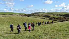
Part of the twenty strong group.
Though it was sunny, there's been a change in the weather.
It was blowing quite a cold wind at Scotland's most southerly point.
We began the walk along the western coast of the South Rhins.
Below us was Gallie Craig, the feature that is Scotland's most southerly point.
A full zoom caught the outline of both the Mountains of Mourne and the Isle of Man
With Scoop in charge there was always going to be plenty photographs taken.
Gallie Craig
The view back to the lighthouse
Kennedy's Cairn
A steep detour for the brave to view the caves.
Cairnie Hill over Carrickcorie
Double dykes earthworks attributed to the Picts
Heading for Liverpool Heysham from Belfast.
I needed a full zoom to get the picture.
I stand corrected about these two ferries. Our man in the business has informed me that they are the Heysham to Belfast ferries; either the Stena Precision or the Stena Performer. Thank you for putting me right F. The last time I travelled by ferry from Heysham was in 1972
East Tarbet
Around Carrickamurlan there was activity in the water ?.................
..........whatever it is, it's surfacing.............
..............here's the chappie, Salty or Sandy !
The sun is low in the sky, only 78 days till the winter solstice !
Bridge over the Kirk Burn
This stone bridge over the Kirk Burn led to the remains of old Kirkmaiden church and burial ground.
The church was dedicated to St Catherine, recorded in 1386 but replaced in 1638 by the Kirkmaiden Kirk.(just noticed the numbers are the same, I wonder whether that was deliberate).
The remains are now little more than grassy banks covering the foundations.
Two fishing hire boats were seen moving about Luce Bay most of the day.
Kirk burn to Auchie Glen. Trees planted and woodland managed by one of our very own walkers.
Lunchtime view.
Closer.................
................and closer for a particular blog reader (not modern power lines, but power lines)
Interesting cloud formations.
East Cairngan
Above, bottom left, at a rough estimate 500/600 bales.
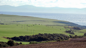
Back over to the West Coast with views to the Galloway Hills.
A picture that was crying out for the 'Vignette' enhancement
We avoided this handsome chap. He initially moved his front legs, but after second thoughts just kept a beady eye on us.
Descending to Mull Glen
Seals in West Tarbet Bay.
A rocky crossing.
There must have been tumultuous activity back in the day judging by the folds in the rock formations.
Mull road between West and East Tarbet.
Time for a sweetie distribution.
The amateur entomologists in the group agreed that this was a crane fly.
Although harmless it has a rather menacing tail.
East Tarbet information board.
Ruined boat house leading to Nannie Nairds Heughs.
Looks as if we were being shadowed !
Scones, jam, tea and coffee beckon.
Here's
Scoop's Pictures
We couldn't have wished for a better day.
The walk concluded with a very rare happening when all twenty walkers sat down for after walk refreshments in the wonderful Gallie Craig.
Here's the report.
Wigtownshire Ramblers Report by Scoop
Mull of Galloway Figure of Eight
After having to cancel this walk in August owing to torrential rain, it was with much relief that the heavy overnight rain petered out as the walkers drove from all parts of Wigtownshire to reach the Mull of Galloway, now bathed in glorious sunshine. With the Isle of Man standing out clearly in the distance and Northern Ireland’s coastline emerging from the sparkling Irish Sea, the Mountains of Mourne were pointed out, with its highest – Slieve Donnard – being remembered by those of the group who had climbed it in 2013.The group of twenty set off down the west side of this peninsula, soon reaching its southernmost point – a craggy rock formation called Gallie Craig, and stopped for photos before continuing onwards. The iconic view of the Mull of Galloway with its caves below and was captured on camera by many before a pause close to Kennedy’s Cairn to hear of its reason for existence. Kennedy was a gamekeeper whose employers built this broch like structure with stone steps jutting out of it for access to its top, to lay snares to capture rooks which preyed on other wildlife.
The views along this stretch are beautiful and spectacular and there is much evidence of its forming. The rock, greywacke, is either grey or red in colour, dating from 400-500 million years ago, when it was deposited horizontally in beds a few feet thick, deep on the ocean bed. There followed a period of deformation which produced major folds and faults, altering the beds to almost vertical layering. Once uplifted the rocks of the region were now exposed to erosion. It is the effects of a series of glacial periods (ice ages) which have created most of the scenery seen at the Mull of Galloway.
After double dykes, the site of Iron Age workings, were crossed, the road was reached, near West Tarbet. The route now picked up above East Tarbet and followed the coastline northwards, looking down onto numerous tiny bays with their fascinating rock formations, in and out of the water, back towards Mull of Galloway lighthouse at the very tip of the Rhins, and north to Maryport and Cailiness Point. Standing out clearly in Luce Bay, Scare(Scaur) Rocks could be seen, home to thousands of pairs of nesting gannets in the summer. Just before a dyke was climbed, with the aid of a stile, the group stood for a while above a circle of rocks through which, when the tide is high and the winds are stronger, seems to act as a blow hole. However, the access to its middle was shown to be through a gap on the seaward side. It is a wonderful sight on such occasions.
Heading for Portankill, following way markers along a track which frequently dipped and rose , the walkers turned inland beside Kirk Burn. Brambles and sloes were still seen in abundance in the glen. Stopping to inspect the remains of Kirkmaiden Church, now covered in grass - replaced in the 17th Century by the church which stands today in Kirkmaiden village – the group rested before completing this section of the walk.
Way markers indicated the crossing of the Mull road onto Cairngaan farmland and the entry into Auchie Glen with its attractive woodland. The grass pathway has been mown, keeping an easy surface over which to walk and numerous trees of an amazing variety have been planted over many years. All seasons have their special interest here. As the end of the woodland was reached, a ploughed field with an accompanying group of large rocks was chosen as the lunch spot. A clear view of the Mull of Galloway, Isle of Man and Northern Ireland added to the pleasure of the group, while binoculars were passed around to try to guess the type of vessel seen in the Irish Sea. After numerous suggestions it was eventually identified as an un-laden container ship!
West Cairngaan Farm was passed before the walkers reached the rugged coastline on the west side again. It's an area of rocky outcrops, Roman hill forts, caves and nature at its best. As the group neared West Tarbet their attention was taken by three seals which started to make their way towards us.
Once again we crossed over the road between the Tarbets, this time dropping down to
East Tarbet Bay. In the past, paraffin and other supplies for the lighthouse keepers and their families were brought by boat and stored in the stone building here whilst the newer, larger one is used by shell fishers. An information board near them was perused before the last section of the walk was tackled.
A steep climb hugging the east side of the fence was followed by more uphill walking until the group divided naturally into two, following higher and lower narrow tracks. The first of these groups ‘cheated’ by going through the first gate reached, crossing a field to the road from where there was a short walk back to the cars, while the second group kept walking to reach the dyke which surrounds the Mull of Galloway reserve and then had a hefty climb back to the car park!
Everyone was made welcome in the Gallie Craig Coffee House with tables laden with scones, tea and coffee, served with smiles and great service. The scones were excellent!
The walk on Saturday 11 October is a C+ one of eight miles – a walk around Lochinch Estate which includes the summit of Balker. Meet at the Riverside, Newton Stewart at 9.15am, at Port Rodie, Stranraer at 9.30am or at the walk start at Castle Kennedy Garden Centre, at 10am. For further details or if going to the start please phone the walk leader on 01776 700707. New members are always welcome.


Wow!!! Absolutely stunning! So much beauty here.
ReplyDeleteIt was a great walk Linda
DeleteThe shadow images are brilliant, and there's breathtaking scenery from every angle. It did look pretty breezy and chilly, but, the sun was shining for such an invigorating hike. (Ah, no matter whether they're modern or not they're like a path across the countryside leading the eye onto somewhere interesting. :)
ReplyDeleteCould you see the swan in your cloud formation?
Hi Rose, we are kindred spirits concerning power lines, I'm glad you like them.
DeleteWhen Shorty first pointed out the clouds that particular one looked more like an upside down tornado. By the time I'd put my coffee down and got my camera it had changed. Still quite a cumulus though.
Love this hike-what were those first creatures in the water?
ReplyDeleteWe have both common and grey seals off the coast Lynn, that particular one looked big enough to be a grey seal. They're quite inquisitive (and adorable) creatures whenever anyone passes by.
DeleteI enjoy a good coastal walk. Great selection of photos. I've only visited that area once and never had time for a proper exploration.
ReplyDeleteThe Rhins coastline is unbelievable Bob. Any zoom on an OS map will bring up coves and crannies over every headland. Some of the names too make the mind boggle. There's Inchslithery, West Bay of Slochlaurie, Sloucheen Slunk, Scutching Stock and where did Yellow Horse come from. I've walked most of the coastal paths but I like to explore as well. I'll never live long enough to get to explore all the Rhins of Galloway.
DeleteThis comment has been removed by the author.
ReplyDelete