It's Saturday the 5th of November,and todays walk is on the North Rhins Coastline.
We did part of this walk back on April the 5th this year.
That blog is here
April Walk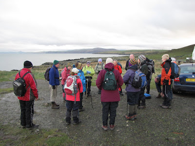
18 walkers meet at Corsewall Lighthouse to begin todays walk.
I hope todays walk leader doesn't mind me copying her press report here...it'll save me a lot of writing.(Info for my Richmond,Nelson NZ reader-that would be your cousin)
It was a damp but clear day when 18 ramblers met at Corsewall lighthouse for a coastal walk to Lady Bay . This was a rough walk, with some scrambling up rocks, the summer growth just dying down along the cliff edges, narrow or non existent paths and plenty of mud. As it had been raining for the last week the burns were swollen, giving some excitement at their crossing, and the ground was saturated so that boots stuck and the party were quite dirty at the finish.
There were plenty of compensations though. As this was a quite unpopulated area, with not many walkers passing this way, the wild life was in abundance. There were plenty of deer to disturb, hares in quantity, snipe and pheasants, seals and shags, and some great badger sets.
The iron age fort, Dunskirloch, at Corsewall Point began the day and one at Caspin was passed around the half way point where later kelp gathering operations had also left their mark. Both forts are difficult to visualise, being rocky, sea girt outcrops with very little of the walls to be seen. Barney McGhie’s cottage at Portmullin, a salmon fishing station, was still standing quite ruinous, but interesting to compare with the picture in Innes Macleod’s book Discovering Galloway.
Lunch was taken on the beach when Milleur Point had been passed and the walkers had entered the comparatively calm shores of Loch Ryan with lovely views across to Finnart’s Bay. Here they were treated to a splendid birthday cake from one of the members, the cake actually iced on the beach before being cut!
All day the boats passed up and down to and from Cairnryan and Stranraer, magnificent to see them so close to the shore. The day ended at Lady Bay where an easy route up the road was taken by most, whilst the drivers were transported back to Corsewall to collect the cars.
One of many boggy obstacles.

A welcome sunny interval.
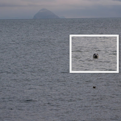
We named this delightful creature Sammy,boy or girl.

Do you remember Salty and Sandy girls?

We were above this ruin last time.This lower path is more of a challenge,but without doubt more interesting.
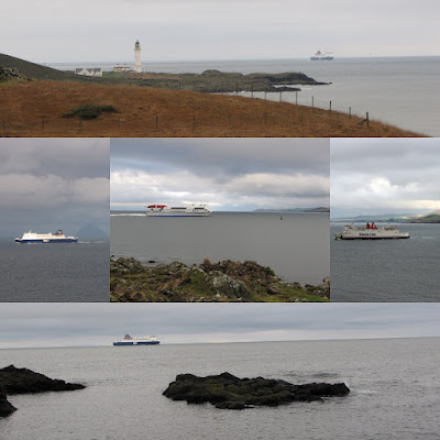
As always,anywhere on the North Rhins coast,a Stena or P & O Ferry is in sight.

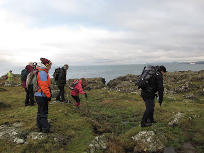
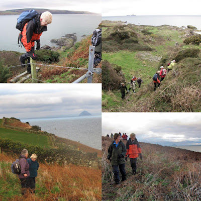
Regular breaks are taken to allow an often strung out line to close up.

Some of the mounds were a stiff climb,while others were more of a scramble.

Finding the least muddy track was the answer to this tricky section.

There are lots of Shags to be seen today.The difference between Shags and Cormorants can be found here
Shags and Cormorants

(Correction 11th March 2012. The above picture is actually at Port Leen, Barney McGhie’s cottage is the ruin in an earlier picture in the post)
The ruins of Barney McGhie’s cottage at Portmullin,a salmon fishing station

Now i get in the picture...thanks for the pics Scoop.I was in a helpful mood today,and dykes,fences and burns would see me assisting walkers in need of a hand.
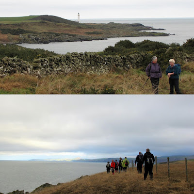
Every now again there'd be a view back to the lighthouse at Corsewall,and each time it looked like we hadn't progressed any distance.

At Burnfoot now,and my offer of a gentlemanly hand is gracefully accepted.

Now the going gets much easier...
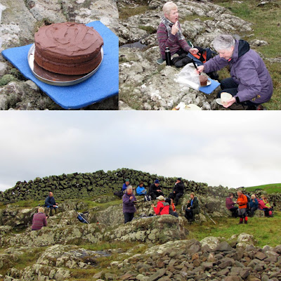
...and just opposite the Milleur Bouy we stop for lunch,and a slice of freshly iced birthday cake.Delicious !
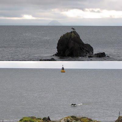
A couple of Oystercatchers kept a close eye on proceedings.No doubt they'll find any fallen crumbs once we leave.

After lunch we begin the last stretch...
...which takes us into Loch Ryan.Along here we pass a point known as 'The Beef Barrel',i wonder where that came from.

Now we reach the point known as Marsh Slung(Maybe another reference to Slewtrain?),with a well made drystane dyke on a steep slope.Pointing back the way we just came are the two signs 'Footpath' and 'Bull keep out'...neither of them seemed appropriate.
From here we head over a field which gives a clue to the name Marsh Slung,and find the road down to Lady Bay.Most of the walkers now head up to the road,while the car drivers collect their vehicles to transport other drivers back to Corsewall.
I'd come out today unsure whether i'd be walking.A lovely walk temporarily diverted attention from my ongoing health issues.

 Custom Search
 This was the view over to the Galloway Hills from above Douglas Ewart High School.


 This sits outside the Galloway Arms Hotel...it looks like the plants like the cigarette stubs!


 The colour's there if you look for it.My walk certainly cheered me up.


