Join me for a road trip.
This trip was from Glasserton Church Car Park to Newton Stewart,but the camcorder shifted in the back window,hence it being shortened to Sorbie.
I'll be using Audio swap to get some suitable background music.
Below are the music details.
It Was Tomorrow
artist: The Hacker
album: Art et Industries
length: 10:48
label: Different
genre: Dance & Electronic

 Custom Search
Friday, 20 May 2011
Tuesday, 17 May 2011
Colour on a dull day
It was a dull day this Tuesday the 17th of May.
I took a little walk from Auchinleck in the Galloway Forest Park around the Pulnee and Polbae Burns.
Below are a few of today's pictures.


I took a little walk from Auchinleck in the Galloway Forest Park around the Pulnee and Polbae Burns.
Below are a few of today's pictures.


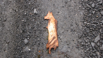
A piece of bark from logging operations
(Amazing likeness to an animal)


Some mushrooms for Tammie Lee


Monday, 16 May 2011
My Old School
My old school,Bell Baxter in Cupar,Fife,Scotland has become a YouTube hit.
Here's why
I just love it
Here's why
I just love it
Sunday, 15 May 2011
Wigtownshire Ramblers-Shalloch on Minnoch-May 2011
Three and a bit years ago,I failed in my attempt to climb Shalloch on Minnoch with the Ramblers.
March 2008 Crocked
Apart from the occasional wander around the foothills,I haven't had any attempts since.I'll be up today
 In the above picture we're heading towards Kirriereoch and Shalloch on Minnoch.
That's as far as we got,we weren't starting the climb from here.Our walk leader arrived back with one car driver after having left one car at the walk finish.
I've again written the press release for this walk so I'll just copy and paste that below.


March 2008 Crocked
Apart from the occasional wander around the foothills,I haven't had any attempts since.I'll be up today

That's as far as we got,we weren't starting the climb from here.Our walk leader arrived back with one car driver after having left one car at the walk finish.
I've again written the press release for this walk so I'll just copy and paste that below.

Climbing Shalloch Hill

Can someone tell me what the lines are ?

Atop Shalloch Hill


Caerloch Dhu and the Pottans

Loch Riecawr and a glimpse of Loch Doon

Reaching Shalloch on Minnoch Trig Point

No views at the moment !

Lunchtime-it wasn't supposed to be a liquid one !

The Higher Summit View

Loch Enoch in the middle.
The Merrick and Kirriereoch under the clouds.

Lochs Macaterick,Riecawr and Doon

Nick of Carclach

Nick of Carclach View

Tarfessock and beyond

Cross Burn wet descent

Cross Burn Lower and View:-Brighter

Back up the Cross Burn
Wigtownshire Ramblers Walk Report
14th May 2011
A cold damp and blustery morning saw twelve intrepid walkers gather at the Kirriereoch car park for todays walk.Two new walkers were welcomed to the group.
After leaving two cars behind they now travelled up the Straiton road a further six miles for the start of the walk.A few miles north of Waterhead on Minnoch they parked up in a disused quarry cutting and began to climb.
The going was typical rugged Galloway Hills terrain.Tussocks, heather and bog meant that progress was steady as they crossed their first obstacle,the Pilnyark Burn.
Eventually they reached their first objective Shalloch.From here they could see Ailsa Craig to the west and to the north Cornish Loch and Loch Bradan.A number of small lochans were skirted around.
As they continued climbing the going became a little easier.Blaeberry and Bog Cotton were prolific.Bog Cotton - or Cotton grass used to be used in the past for making candle wicks and also for stuffing pillows. It was also used in wound dressings during the first world war.Nowadays it's considered commercially unviable for harvesting.
Now they were cimbing southeasterly on the slopes between Caerloch Dhu and the Pottans.Below them the Rig of the Shalloch was prominent.Cloud cover obscured all the summits of the 'Awful Hand' range.Arran and Ayr could be seen to the north and west.
Upon reaching the trig point (768) and stone shelter on Shalloch on Minnoch,optimism that the weather was going to improve was soon dashed as the wind and rain increased.A cold and damp lunch break followed.Despite the conditions,lots of light hearted banter bolstered morale.
After lunch they now moved east to the highest point on the Corbett and the highest point in mainland Ayrshire. (The Isle of Arran is managed by North Ayrshire Unitary Authority so technically Goat Fell summit is it's highest point).
At 775 metres high and above the rocky crag known as Maidens Bed the views when the clouds occasionally cleared were spectacular.Below to the north east were Lochs Macaterick,Riecawr and Doon,east standing tall was Corserine and to the south Loch Enoch.
Tunskeen bothy far below, restored in 1965 saw the MBA (Mountain Bothies Association) being formed.
Now the group made their way to Tarfessock via the Nick of Carclach.The drop in height took them below the clouds and afforded more views of the surrounding rugged countryside.
Lochans and rocky outcrops were passed until they came in sight of the steep slopes of Balminnoch Brae leading up to Kirriereoch.It was time to begin the descent.
The descent followed the course of the Cross Burn.For a while the weather worsened and wind and driving rain were endured.
Stumps are all that remain at the site of the now demolished Cross Burn bothy.Remembered by a few of today's walkers it was wigwam shaped.
As the weather cleared and the sun began giving occasional glimpses, the exit to the forest road was inadvertantly missed.The group continued the descent to where the confluence of the Cross and Kirshinnoch Burns become the Kirriemore Burn.
An unsuccessful but entertaining attempt to find a way through the forest resulted in a short retrace of steps back up the Cross Burn to the Pillow Burn and the forest road.
Drivers were now taken back to the vehicles while the remainder enjoyed the saunter down the forest road to await their respective lifts.A wonderful walk despite the weather.
The next walk, on the 21st of May will be a 'Woods and Hills in the National Scenic Area' circular B grade walk of 8.5 miles.
Meet at the Breastworks, Stranraer at 9.00am,the Riverside car park Newton Stewart at 9.30am for car sharing, or at the walk start at Anwoth New Kirk (NX 582 559 ( N.B misprint in programme has NX 582 599) ) at 10.00am
New members are always welcome, for more information or if going to the walk start, contact the walk leader on 01776 840226
Wednesday, 11 May 2011
Walkfest-The Glenkens-Polmaddy to Kenbridge
Tuesday the 10th of May and I'm away on another festival walk.
The description below is from the Walkfest website.
Newton Stewart Walking Festival
After registration at the WRDC office we board the bus to take us to Polmaddy.
Also on the bus is the group who are booked to climb Corserine.
A run up the Queensway to New Galloway where we pick up our walk leader Bob Peace,ex policeman and member of the Galloway Mountain Rescue Team.
Mountain Rescue
 After being dropped off at Polmaddy,we begin the walk alongside the Water of Deugh through the Carse of Dundeugh.A red squirrel and a colourful caterpillar are spotted.
The path has a lot of overhanging branches,so progress is initially quite slow.
It's quite a dreich morning so I'll not get too many good pictures.
We're a group of 25.
 After a glimpse of the Kendoon Power Station we turn north following the Water of Ken till we reach Glenhoul Bridge.
 It's an old bridge,but has a fairly new memorial stone at one end.We couldn't quite make out the name,but the middle one was Alexander.Perhaps a covenanters memorial ?
 Bob is a knowledgeable guide and imparts information about the Hydro schemes and the Covenanters.
Reaching the dam on the Water of Ken we turn east over a boggy area to reach the tarmac road at Blackwater
 The prefabricated corrugated building was once the accommodation for the dam builders.It then became a youth hostel and is currently unused.
 After crossing the Blackwater bridge,we continue east following the Black Water.

We pass a beautiful double drop waterfall known as Chapel Linn.

 The path continues to follow the Black Water.It's understandable that bog cotton flourishes.
After three or four kilometres of occasionally boggy moorland we reach Butterhole Bridge.
Here we join the Southern Upland Way and change direction to head south.
We have our first lunch break along here.

 Once we're on the move again it's more of the same damp moorland.There's a settlement marked on the map,but our leader tells us he's never seen any signs of it.There is though close by a "Hut Platform" which stands out quite prominently.We reach the Earlstoun Burn.
Accompanying us on today's walk is the Galloway Kite Trail Community Liaison Officer,Callum Murray. He's identifying bird calls and keeping an eye out for his Red Kites.
 As the day moves along so the weather improves.
Behind us Cairnsmore of Carsphairn is now clear of cloud and easily recognisable.
 Deciduous trees and cattle mean we must be closing in on civilisation.That's a Sweet Chestnut tree above in the above picture.
 After rounding Ardoch Hill we stop for a second break.The women outnumber the men today.Talking to today's walkers they've come from near and far.
Amongst those I talked to were people from Melrose,Leeds,Hull,Essex and Glasgow.
A London Underground Controller is up for his fourth Walking Festival.

 On the move again we've a long downhill stretch taking us into Dalry.
(To the uninitiated St John's Town of Dalry is known locally as plain Dalry,pronounced Dal Rye and not Dawlry)
 It's a very historic,neat and tidy village.
Here's a link to it's Undiscovered Scotland page.
St John's Town of Dalry
 Out of the village we begin to climb again.It's much brighter now.
 We're climbing Mulloch Hill for it's panoramic views.It's only 170 Mtr's so it's not a hard climb.
 While Bob's setting his camera up for a group photo I take this one...
 The trig point has a flush bracket and lovely all round views.Bob identifies all visible hills.There's a nice view over Loch Ken.
 The descent takes us down to Boatknowe where we join the riverside footpath.
 A tall standing stone and a pair of Clydesdales were amongst the points of interest.
 Various plants and the continuing life in a dead tree were pointed out by Callum our wildlife man.
 And finally the walk end at the Ken Bridge Hotel where welcome refreshments were taken.
The bus home was delayed due to a blister developing within the group of Corserine climbers.......................................................................

The description below is from the Walkfest website.
The Glenkens Polmaddy to Kenbridge | ||||
Distance: 18km | £ 10 | |||
Ascent: 400m | Ref 5-2 | |||
| ||||
 This is another first for Walkfest, walking the length of the Glenkens. This walk, which is mostly on way-marked paths, offers a full day in the lovely district of Glenkens, renowned for its Covenanters, wildlife and one of Scotland's earliest hydroelectric schemes. The route, which starts at Polmaddy, follows the Black Water Burn to join the Southern Upland Way at Butterhole Bridge. After crossing open moorland and pasture fields providing views across to the Rhinns of Kells, we leave the Southern Upland Way at St John's Town of Dalry and climb to the viewpoint of Mulloch Hill to enjoy the vista of the Ken Valley before descending to the Kenbridge Hotel.
Newton Stewart Walking Festival
After registration at the WRDC office we board the bus to take us to Polmaddy.
Also on the bus is the group who are booked to climb Corserine.
A run up the Queensway to New Galloway where we pick up our walk leader Bob Peace,ex policeman and member of the Galloway Mountain Rescue Team.
Mountain Rescue

The path has a lot of overhanging branches,so progress is initially quite slow.
It's quite a dreich morning so I'll not get too many good pictures.
We're a group of 25.


Reaching the dam on the Water of Ken we turn east over a boggy area to reach the tarmac road at Blackwater


We pass a beautiful double drop waterfall known as Chapel Linn.


After three or four kilometres of occasionally boggy moorland we reach Butterhole Bridge.
Here we join the Southern Upland Way and change direction to head south.
We have our first lunch break along here.


Accompanying us on today's walk is the Galloway Kite Trail Community Liaison Officer,Callum Murray. He's identifying bird calls and keeping an eye out for his Red Kites.

Behind us Cairnsmore of Carsphairn is now clear of cloud and easily recognisable.


Amongst those I talked to were people from Melrose,Leeds,Hull,Essex and Glasgow.
A London Underground Controller is up for his fourth Walking Festival.


(To the uninitiated St John's Town of Dalry is known locally as plain Dalry,pronounced Dal Rye and not Dawlry)

Here's a link to it's Undiscovered Scotland page.
St John's Town of Dalry


The bus home was delayed due to a blister developing within the group of Corserine climbers.......................................................................

...............but plenty of colour around the hotel to photograph.
An accurate pedometer measured the distance as 12.14 miles.
I'm coping better with these mid distance walks nowadays.
A very enjoyable walk in good company.
Subscribe to:
Posts (Atom)

Photographs

Morning deer

is someone watching me