Clicking a picture will bring up all the posts pictures in a slideshow. To view an individual picture in full screen, right click and select 'Open link in new tab'

Tuesday 27 May 2008

A walk round Eggerness Point

Yesterday was Bank Holiday Monday the 26th of May.Today it rained.I'm glad i got the following pictures before the weather changed.
I'd planned to go and look at some rock carvings along the Eggerness headland.I'll make enquries as to their location next time i decide to go and look at them.
After setting off having parked just outside Garlieston village, the first thing i noticed was how advanced the wild flowers were.

There's a lot of colour about..

...and the young birds are taking to the air.

The path through the woodland stays close to the shore,and judging by these pictures plenty of thought for the animals have gone into the woodland management.

Eventually the path emerges into farmland,and the waving barley makes a foreground for the hawthorn blossom and the flowering rhododendrons.

Once clear of the woodland,showing beyond the point of Eggerness, some ten miles across the water,is the Borgue peninsula of Kirkcudbright,views of the Auchenlarie Holiday Park,a startled heron leaving,and views up towards Wigtown Bay.

Upon reaching more woodland i'm drawn to these objects on the rocks below me.
There's a bit of a path down,so i'm going to have a look.

As i mentioned in a previous blog Garlieston is known as the home of the Mulberry Harbour,and these are remnants.These down here are 'Beetles' a kind of pontoon.

I don't think it's advisable to get pictures this close.After a little bit of rocking,i soon retired to a safer distance.

A 'fort' shows on my ordinance survey map,and i assume these ivy coloured drystone walls are whats left of a bygone age.

Continuing on through the woodland,with Eggerness Farm on the left,i reach Castle Head.This is as far as i'll go today.Another time i'll take a look at Innerwell Port and Fishery just a little further north.
I sat for a while at Castle Head watching the waves crashing on the rocks and the seagulls gliding in the wind.
After depleting my flask of coffee,i retraced my steps back to my car.
How enjoyable was that.

Sunday 25 May 2008

A Day in May in Wigtownshire


This is a photo compilation of a walk i took recently.
I can see the top of Barrhill Farm woods from my house.
I've done a video clip from here before.
This hopefully is a better version.
The music is by Vangelis,and this particular track is the title music from the 1982 film 'Missing'.It's from his Themes Album.
To see this in better quality go to
http://www.vimeo.com/1065404

Wigtownshire Ramblers-Isle of Whithorn to Garlieston

It's Saturday the 24th of May,and todays walk is a coastal walk from the Isle of Whithorn to Garlieston.I'm not in top form at the moment,but decided i'd go anyway.

Car sharing from Newton Stewart and we head for Garlieston.We're taking the 10.35 bus to the Isle of Whithorn.

Nineteen walkers soon fill the regular 415 service,and 25 minutes later we disembark at the Isle.

It's a little windy and overcast.A good day for walking.

The bus has deposited us almost on the edge of the village,and as we set off along the Garlieston road we view the Isle Castle which is one of the village's oldest buildings.
The pace is a moderate one,but i'm distracted by muscle pain in my right leg..

..and not paying enough attention to the views.
A short history lesson at Portyerrock Bay.
This is a passage from Garliestons own Website.

In Garlieston square is a boulder erected to commemorate the part played by Garlieston in 1943-1944, when full scale sea trials of the structures and ideas which resulted in the floating Mulberry Harbours, installed off Normandy immediately after D-Day to supply the armies in the Battle of France. Garlieston was chosen as a secret location for its trials because of the large rise and fall of tides on an exposed coast, similar to that of Normandy. The harbour, Rigg Bay, and Portyerrock Bay were areas of frantic activity at this time, used to test and discard unsuccessful ideas and develop the successful one with the best procedures and gadgets for assembly, securing, towing and planting. From the harbour one can see two wrecked "beetles", pontoons stranded on Eggerness rocks , and at Rigg Bay, the metal structure with cormorants nesting on it is what remains of a "hippo", one of the unsuccessful proposals.

Portyerrock House...

...and Portyerrock Mill next to the Millers cottage nicely restored
Here we take the coastal path.

Lots of gates provided for walkers.

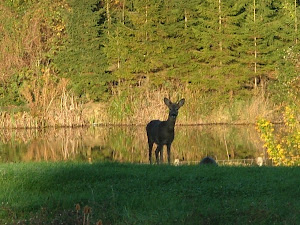
And now craggy cliffs,belted galloways and remnants of long ago military activity.

Time for refreshments.This break takes away my muscle pain,and the second half of the walk becomes much more enjoyable.

Back on the move...

...and single file on the narrow path.

While driving from the Isle of Whithorn to Garlieston,i've been intrigued by this odd looking structure.Today i find out what it is.

A fisherman baits up,there's supposedly Mullet,Pollack,Bass,Wrasse and Dogfish to be caught.A local walker says he'll catch Mackeral.

There are lots of seabirds along this coast,and a lot of them are cormorants.

Over this wee burn,and we're getting closer to the odd structure.

Behind and to the west we can see Palmallet Loch and further west is Whithorn.

And now we take a few moments at the teapot lid.This is all that remains of Cruggleton Castle.The site has probably been used since the iron age.What's left here dates back to the 13th century.It became a ruin towards the end of the 17th century.Unless it gets some restoration work in the very near future,it'll no longer be the landmark it is now.

With Scoop 1 away on holiday, i do the photo shoot.

Now after a short break,and with the weather improving we're at the edge of the Galloway House Estate.
Galloway house is the historical seat of the Earls of Galloway,but depleted wealth meant having to sell in 1908.
It's had numerous owners since including Glasgow City Council who between 1947 and 1976 used it as a residential school.
More on it's history can be found at
http://www.geo.ed.ac.uk/scotgaz/features/featurefirst5061.html

I wonder whether there are secret tunnels in this cave.

This is the rear view of the house.

And here's a picture i took earlier this year of the front.

The beach at Rigg or Cruggleton Bay now takes us into the house gardens.

Lots of colour in the various plants and trees,including the Handkerchief Tree(Davidia involucrata)as seen here.
Looking at the Galloway House Gardens photo gallery there's a picture of one of the last visible remnants of the Mulberry Harbour.
That can be found at
http://www.gallowayhousegardens.co.uk/?page_id=12&picture_id=33

This has been a lovely detour around the garden,and while keeping our eyes open for a parrot...

...we make our way back to Rigg Bay and the path.

Passing colourful shoreline plants and dead trees Garlieston comes into view.

I wonder whether this anchor has a colourful history.

Back in Garlieston it looks like the tranquility of this place may not last judging by the amount of construction at the harbourside....

...and finally back to the car park.
Had i not felt so rough at the beginning of this walk,this would probably have been one of the nicest walks i'd done,and I now have more lovely places to show visitors.

Saturday 24 May 2008

Leckhampton Nature

My youngest sent me these pictures from a recent walk she took up Leckhampton Hill in Cheltenham.

The author of this blog feels privileged to be allowed to upload them.

The bird is almost certainly a young long tailed tit.Perhaps someone can positively identify the purple flower

Monday 19 May 2008

Flights and Fenders

Sunday the 18th of May.
I had a very enjoyable day today.
The Scottish Model Airshow was held at Castle Kennedy....

....and the Wigtownshire Yesteryear Transport and Machinery Clubs held their classic car rally at Stair Park Stranraer.

I'll be doing some features,i.e Youtube or Photostory on both of these shortly.

Sunday 18 May 2008

Wigtownshire Ramblers-Bennan

Saturday the 17th May 2008.Todays walk is on the programme as forest trails.I've had a painful click in my left knee since yesterday.I hope it doesn't become a problem.
We're starting from the Glentrool visitors centre at Stroan Bridge.There are fifteen walkers today.Almost all are regular walkers that i've come to know.

Once we're assembled as a group,our walk leader informs us we're heading to the summit of Bennan.We're soon heading off,hoping to keep up a reasonable pace.The visitors centre stops serving refreshments at 4.15 and a number of ramblers want to be back before it closes.

Bennan at 562 mtrs sits under Benyellery 719 mtrs in a line with the Merrick 843 mtrs.A radio mast is perched on the summit.

As usual there are plenty of photocalls.Who's that hiding behind the tall chap?

We're soon gaining height with views to the south of Lammachan....

...and north west below us is Palgowan Farm.

It's a long gradual climb and everything behind to the west comes into view.

The track does a steady climbing arc around Bennan,and we can see people heading upwards towards Benyellary.


We've been walking about two and a quarter hours as we near the summit.As with a lot of the Galloway hills,there are small lochans at this height.

Now at the summit and a welcome break.It's a lot colder up here,and everyone is now well wrapped up.My knee hasn't got any worse.I'm sure i'll be ok now.

Even the dullness doesn't stop the views.Here we can see over to the Artfield Fell wind farm...

...and here over to Ailsa Craig with the Mull of Kintyre beyond.

Refreshed and wrapped we set off on the return leg.We're heading down one of the steeper slopes of Bennan.

We descend between rocky outcrops and more lochans.Bowl like depressions in one of the rocks.What made these?

This is the most scenic part of the walk.To the north east is Benyellary and a mist shrouded Merrick.

To the south west we can see the Mull of Galloway,and in front of us the hills that encircle Glentrool.

Single file for a safer descent...

...and watching where you put your feet makes for a steady climb down.

We're too soon back onto the main track where forestry operations have been taking place.It's suggested that these odd thin trees have been left up because they didn't meet the required girth.Sounds like a plausible explanation to me.

Not far now.Wait for me!
A few hundred yards from the finish and a pedometer reads 9.2 miles.
I joined a few other walkers for a very welcome cup of tea at the visitors centre.My knee has sorted itself out.All in all a very good walk in excellent company.
Related Posts Plugin for WordPress, Blogger...

Photographs

Creative Commons License
This work is licenced under a Creative Commons Licence.

Morning deer

Morning deer
is someone watching me