
 Custom Search
Monday the 11th of August.
Up early for the half seven boat from Cairnryan to Belfast.

Quite a rough sea, but the crossing was ok.
The M1 motorway soon had me down as far as Augher. The twin villages of Augher and Clogher soon slowed me down. I took as long getting the last third of my journey as the first two thirds had taken me.
After arriving in Glangevlin and sorting out my sleeping arrangements, I drove south through Mohill and Drumod to get to Rooskey/Roosky.

I was hoping to meet up with the good folk, Phil and Anne from Florida that I'd visited in December.(as it happened they went up to Glangevlin, but no worries, they were on their way back and I was warmly welcomed (and fed) in the house above ).

I headed out for a look at Rooskey.
The sign on the left intrigued me so after a Google search the only place to find 'Maanpano' in English is in Rooskey.


As the mighty Shannon flows through the town there would be boats.

This hotel was once called the Shalimar (or Shalamar) and was run by Phil and and Anne.
It's changed quite a bit by the look of it.

Not really a panorama but it gives the right impression of the layout.
(You can actually get a better picture on Google Street view)

Views across the Shannon as I'm walking down to the lock gates.

These guys are heading to Dublin.

The lock-keepers told me that the gates were 170 years old.

Heading back to the village I met Phil and we called into a local hostelry for refreshments.
(I was meant to meet up with Phil and Anne later in the week in Tubbercurry, but I somehow missed them. I also missed Phil on Thursday in Glangevlin, I'll just have to head back to Florida sometime soon)
That's not Phil above though, he looks much meaner !
That's not Phil above though, he looks much meaner !
So it's back to the 'Peaceful Hills O' Doon' (Dunmakeever) to catch up with my other brother in law.

Tuesday morning and the weather forecast wasn't a particularly bad one.
I decided to take the chance and climb Cuilcagh.
Remember this Climb in 2012

I decided to take the easiest way up and down.

There were a few of these creatures about.

Over to the west I see Benbulben

After crossing the stile that denotes the border between the Republic of Ireland and Northern Ireland I crossed to the path that comes up from Marble Arch.
In the last few years this has become a very popular climb from the northern side and the erosion is now beginning to show.
I see too that it's recently been closed on the WalkNI website.

Brackley Lake (note, not lough) view.
I got better pictures in 2012 but the clouds were more interesting on this climb.

Recently there has been a lot of development and promotion of the Geopark and the Brefni Burren
Belcoo and Lough Mcnean.

Bottom right above and not so clear is Benbulben again.

Another 'Selfie'
I might have mentioned this before, but the theodolite mounting plate in the middle has been inscribed 'P.McGovern 1948'. The last picture in this post will be the self same P.McGovern. As a young man he assisted in the construction of this 'Triangulation Station'.

Beginning my descent I saw a group heading my way. I got to the junction before they did, so I waited to say hello. They were the seniors from an outdoor group from where I can't remember. They all looked to be between seventeen and twenty one anyway.

Onwards and upwards they go.
I was pleasantly surprised to see the litter I'd spotted on a previous climb had been cleared away.

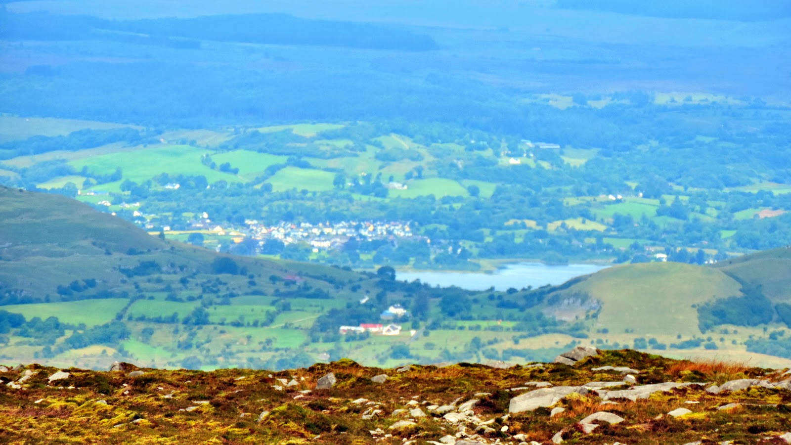
So on my descent I begin taking pictures down towards Glangevlin.

My great nephew Barry is muck spreading.
The more I zoom in the more distant houses are foreshortened, the houses at the top of the picture are much further away than they appear here. The previous picture tells the story a little.

Now even lower, many of the houses in the valley are no longer in view.
These are probably the highest maintained meadows on Cuilcagh Mountain.

Back down to the house and after a bite to eat and a cuppa I'm up 'Brian's Hill' to take a couple more pictures.

To identify the road turning into Dunmakeever go to the last visible telegraph pole (on the left), two thirds down and a little to the right.

Zoomed in from the same spot, here's a closer look at my nephew's house.

Mr P. Mcgovern of the Trig Point atop Cuilcagh.
Part two will follow soon.
The Old Fair at Tubbercurry and Florence Court will feature.
I'm having a great time.


Thoroughly gorgeous and captivating views! And I love the narrowboat, too!
ReplyDeleteBritain and Ireland have a long history of canals Linda. Up to the 1950's there would only be working barges on them. A working barge is a rare sight nowadays.
DeleteWonderful pics-and looks like you had all good weather
ReplyDeleteGood weather Lynn, but wet underfoot up the mountain. Luckily I packed plenty of spare footwear.
DeleteYep, I'm definitely going to need instructions on doing successful selfies - I might start experimenting (I think I know how to work the timer) gosh, I haven't got to position myself and get the look going etc in 10 seconds?? :)
ReplyDeleteYes you have Rose. It's sometimes a challenge if the only place your camera will sit is a rock fifty feet away. A quick race over uneven ground, into position and then try to appear nonchalant. If it doesn't work first time, try try again. Lol
DeleteLOL - I figured that was what was required! It's the appearing nonchalant after the dash that's got me worried, particularly if you've twisted or broken something en route! ;)
DeleteLooks a great area. I once entertained the notion of kayaking down the full length of the River Shannon as it looks a great river system through the interior of Ireland but the money and effort involved, plus the complex logistics travelling over from Scotland then hiring a suitable craft near the start of the river put me off.
ReplyDeleteHi Bob, I wonder what the squatting laws are in Ireland. Along many parts of the Shannon are unfinished houses, left as such after the crash. I think the banks own most of them as they were taken for collateral when the builders were bankrupted. Maybe a squat and build yourself a boat ha ha. I remember back in the 90's when everything on the Shannon/Erne waterway was hunky dory bumping into many folk navigating the river from Lough Erne and Carrick on Shannon. Never came across many kayaks but I see there's a couple of clips on youtube. Must be a challenge then.
Delete