Clicking a picture will bring up all the posts pictures in a slideshow. To view an individual picture in full screen, right click and select 'Open link in new tab'

Wednesday, 25 June 2008

Cushendun

Before heading back to the boat from my Ireland trip,i headed down the Glens of Antrim to visit the good folk of Cushendun.

I arrived via Glenballyeamon,looking as welcoming as ever.

The local councils in both the north and the south of the country have made a grand job of naming townlands and districts in English and Gaelic.
More on the luxurious Mullarts can be found at
http://www.mullartsapartments.co.uk/

Down next to the very quiet beach....

...has been placed this lovely sculpted stone.
I'm not sure whether my grammar is correct,but it reads.
today the misty hills are filled with water : the dun runs brown round stones and over stone or amber over gravel : a bleached branch stranded by spate beside a swaying foxglove rooted in stony splinters : loud it sounds,brimming the air with rush and splash and chatter and over : under these an endless roar,foam-white at boulders damming : ramming froth in the sharp crevices abrupt : it hurries along the glen-foot : past the dripping trees and the combed grasses and the beaded whins : the sounds of running water are it's own,it's natures patient,pliant to all use : but not it's voices,not it's coloured shapes,may offer easy symbols,metaphors or simply pleasure going it's own way.
john hewitt


Like the Cree back in Newton Stewart the Dun's been running low on water.It'll soon be back to it's tumultuous flow,rain's on it's way.

The last time i visited the Bay Hotel had gone,and construction had just started here.It's still scenic,but i think it's lost something in this view.

And here's another victim of the times.

It still retains much of it's character though-even if Mary Mcbride's is no longer the smallest pub in Ireland.

The inscription reads
Johann
Sculpted by Deborah Brown and presented by her to the people of Cushendun August 2002
a goat was the last animal to be culled in the foot and mouth outbreak 2001


Johann was a friendly goat for most of the time,but like all goats he could be temperamental.


The green glens of antrim.

And the excellent Cloneymore for a great nights sleep and a hearty Irish breakfast.
http://www.discovernorthernireland.com/product.aspx?ProductID=4284

Tuesday, 24 June 2008

Lough Keenaghan

On my recent Ireland trip i was looking for somewhere to relax and drink some coffee from my flask.

About 3 miles north of Belleek in County Fermanagh i came across Lough Keenaghan.
A beautiful little spot.

Sunday, 22 June 2008

Wigtownshire Ramblers-Carstramont and Mount Pisga

It's Saturday the 21st of June 2008,and todays walk is a six mile circular walk starting at Carstramont Wood,north of Gatehouse of Fleet.

Before starting i'd like to point out something about the spelling of Carstramont.
According to the Ordnance survey maps,the woods,the Doon and the bridge are all spelt Castramont,and the settlement is known as Carstramon.Rev C.H.Dick mentions Castramont.A number of Dumfries and Galloway P.D.F's and documents have either Castramon,Castramont,Carstramon or Carstramont.
There is a book in PDF form from Google books,free to download called 'Historical and Traditional Tales in Prose and Verse, Connected with the South of Scotland' published by J.Nicholson Kirkcudbright in 1843 in which the spelling is Carstramont.
This being the earliest reference i've found,and having spent enough time researching the spelling,Carstramont will now suffice for this account.Thank you for your attention to this matter.
Now down to the serious stuff the walk.
Twenty walkers and two canines(Curly and Robbie)gathered at Carstramont woods.

The weather forecast isn't good,and although it was fair when we set of from Newton Stewart,by the time we begin the walk it's drizzling.For that reason,there wont be many good pictures.All weather photographic equipment is in the pipeline.


Heading west over the river Fleet and past Nether Rusco we see the historical Rusco Castle dating back to c1500.


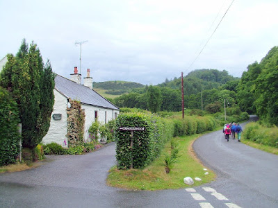
Turning off the quiet B796 we're now climbing.There's no hard climbing today.
Even in the drizzle there are still views worthy of a picture.

Occasional stops to allow the back markers to catch up...

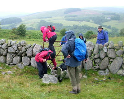
...and obstacles to negotiate,with occasional mishaps.

We're above Ornockenoch and on the slopes of Mount Pisga.Moses climbed a Mount Pisga,perhaps this hill's been named in memory of that.I doubt Moses ever set foot in Scotland,but i could be wrong!

Atop Mount Pisga we'll have a wet lunch.

It looks as though i'm getting damp into the camera.

Lunch over we head down to Ornockenoch.

Ordnance survey don't name the loch,but Rusco's own website name it as Ornockenoch Loch.Try saying that to a taxi driver after a night in the pub.


Now walking alongside Ornockenoch Loch my camera seems to have taken on a lot of water. But wait! It appears to be brightening up.

We're now back on the B796 about two kilometres south of where we first joined it.

A break was taken to admire this handsome Equus caballus.

Back off the road again with Carstramont Woods in sight.


This sturdy stile is further proof that Galloway is walking country.


Walking now alongside the not very fleet River Fleet(this is the first real sustained precipitation we've had for a number of weeks)we're soon back over Carstramont Bridge and the cars.
Todays walk has been wet but not unpleasant.And as usual in the best of company.

Friday, 20 June 2008

The Breffni Burren

On a recent trip to Ireland i took quite a lot of photographs which i'll upload in the form of two or three blogs.
This the first of those blogs concerns the Breffni or Cavan Burren.

Covering a much smaller area than it's more famous cousin in County Clare,the Burren is located in West Cavan between the villages of Gowlan and Blacklion.

The following is a description i've copied from Blacklions own website.

The Burren area is situated south west of Blacklion village. It's a remarkable area of limestone upland (now predominantly covered in commercial forestry) with a dense concentration of archaeological remains, mainly Neolithic and Bronze Age and Early Medieval in date possible from 4000 BC to 1500 BC. A variety of megalithic tombs, court, portal and wedge are complemented by ancient hut sites and a network of relict field walls.

Local folklore tells of a contest between giants to jump backwards over a Cleft. This resulted in the death of one of them, who is supposedly buried in the 'Giants Grave' (wedge tomb). Another portal tomb nearby known as " The Calf House" has a massive earthfast capstone. It gets its name from being converted into an animal shelter at the end of the nineteenth century.

There are lots of megalithic tombs in the area along with cairns, hut sites and pre-bog walls which all suggest considerable settlement here in prehistory.

The remarkable thing about the Burren is that examples of all four types of tombs are found here.

Local archaeologists are regularly adding to the recorded sites in the area, which number well over one hundred so far. Some of the sites are signposted within the forest.

The Burren complex which is now regarded to be of international importance stands on the Cavan Way, a 25 km way - marked walking trail stretching from Blacklion to Dowra and it is a must see for all visitors to the area.


"A quite place where few mortals trend but a neolithic nirvana to the memory of the dead.A timelessness and immortality is felt within my bones,As i sence the earthfast eloquence of silent standing stones".Seamus O hUltachain".

In many of the pictures i've inserted the signs belonging to that particular point of interest.Clicking on the picture should size it large enough to read.

It really is like going back in time here.

The BBC's Britains Lost World programme on St Kilda shows signs of ancient civilisations,perhaps the same people were here.

Apparently the burning of Peat/Turf has been polluting the atmosphere with dioxins for centuries.


I'm expecting to see a cave man at any moment.

I wonder how heavy these boulders are.


This 'Dolman' has signs of recent use.

It would certainly give shelter in a storm.

Much of this site has yet to be uncovered.

I'm only here because my climb up Cuilcagh Mountain's had to be delayed because of mist.

What a brilliant alternative.

I haven't managed to see the Lost Valley(Ancient river sink) or the Promontory Fort.
They're to be enjoyed next time i visit.

Burren (Boireann) means Great Rock,Rocky District or Stony Place,and back at the entrance it shows in these landscapes.
I find it hard to believe that i've been coming to West Cavan since the sixties and this was my first here.It wont be my last.

Monday, 9 June 2008

Sunset over Burley Fields Lake

Burley Fields Lake,Leckhampton,Cheltenham is the setting of this lovely sunset.

Thanks to Sez for submitting the picture.
No blog for a couple of weeks,i've something on.
Back soon
Related Posts Plugin for WordPress, Blogger...

Photographs

Creative Commons License
This work is licenced under a Creative Commons Licence.

Morning deer

Morning deer
is someone watching me