Clicking a picture will bring up all the posts pictures in a slideshow. To view an individual picture in full screen, right click and select 'Open link in new tab'
Showing posts with label Cairngarroch. Show all posts

Tuesday, 3 January 2012

Wigtownshire Ramblers Cairngarroch January 2012

It's Monday the 2nd of January and I've recovered enough from my bug to allow me to get out with my walking group.
This first walk of the year is one we've done before.
July 2009

We start the walk at Cairngarroch Bay, another regular post.
Cairngarroch Bay
Cairngarroch Bay Revisited

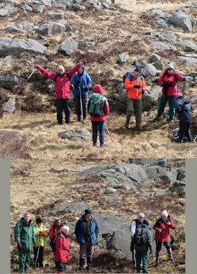
There are nineteen walkers today.I'll be writing the report which will follow the pictures.

Downhill to Cairngarroch

C47 Dakota Memorial Plaque
The Scottish War Memorials Project

I showed the way since very few of the group had ever visited this spot

Climbing Cairnmon Fell

View back to Cairngarroch Bay

Passing by places with names such as Slannax, Strand-Foot, Good Wife's Cave and Slunk Rainy

Float Bay

Oyster catchers on Float Bay

Looking back to Float Bay

Rocky clamber towards Arthur's Slunk

Scrambling up to the viewpoint above Dun Stone

View back beyond Float Bay to Water Cave

Heading inland towards Kenmuir

Kenmuir

Saltpans Bay


I've been loaned a Dumfries and Galloway publication, 'Through the Lens' 'Glimpses of old South Rhins'.
The following picture has been taken from it.
  
This is Will Purves who lived in a cave at Saltpans Bay.
A former circus strong man he lived in the cave for many years.
He'd spend his evenings in the social atmosphere of Clachanmore Smithy, entertaining the company by lifting the anvil from it's stand and carrying it round the smithy.
Annoyed on one occasion by a remark, he left taking the anvil with him and depositing it a quarter mile away at the crossroads, whence it was retrieved by the blacksmith with much difficulty - and assistance !

Saltpans Bay

Passing Red Isle and Stinking Bight

Ardwell Bay


The Wee Ardwell Woodshop


Wigtownshire Ramblers 
Monday the 2nd of January 2012

It was a cold windy day as nineteen ramblers met at Cairngarroch in the South Rhins for this, the first walk of the year.

A muddy track was followed to reach the shoreline at Cairngarroch Bay.Three small deer were seen bounding up the steep slopes above the bay. 
Though the walk was to go south, an early detour was taken to view the memorial plaque at the northern end of the bay.
After a scramble over a rocky promontory this was reached and the significance of the plaque and aircraft remains was explained.A copy of  The Rhinns Forgotten Air Disaster by Sandy Rankin was also on hand.On July the 27th 1944, two C47 Dakota's carrying wounded US servicemen crossed here en route to Prestwick.One never made it over the cliffs and all 22 on board perished.
After retracing their steps to the picturesque fishermans cottage they now followed the muddy coastal path uphill to round Cairnmon Fell.Although the wind was bitterly cold, lots of sunshine compensated.
Continuing along the coastal path they reached the area known as Slunkrainy. Here the steep slopes down to the rocky shore were of 'Stair-Step' topography and undulated in and out and up and down.More deer were seen bounding away over the skyline.
A green field was next to be accessed.It required a muddy passage through gorse, a drystane dyke and three fences of which one was discovered to be a live electric one. 
Now a change of direction took the route inland to pass through Little Float Farm.From here a downhill track led down to Float Bay.
After admiring the presently occupied large beach house the walls of the smaller cottage and surrounding rocks provided shelter for a lunch break.

After lunch more clambering over the rocky shore was followed by a scramble up the steep slopes to access the viewpoint above Dun Stone.The sun was still shining and afforded wonderful views back up the Rhins coastline, including the wide mouth of Water Cave back on Float Bay.
Back inland through open fields and muddy gate entrances brought them now to Kenmuir where some exuberent Lhasa Apsos delighted the group as they talked with their owners.
Now the road back to the shore via Salt Pan Cottage was taken where again the stony coastal path was reached.
Soon though they passed the geological feature known as the Stinking Bight and were on the silvery sands of Ardwell Bay.
After reaching the car park a short road walk up to West High Ardwell concluded the walk.
The day was topped off in a welcoming farmhouse kitchen where all manner of seasonal cakes and savouries,tea and coffee, sherry,port and wine were heartily enjoyed.

Sunday, 20 April 2008

Wigtownshire Ramblers-Millfore via Cairngarroch

It's Saturday the 19th of April,and it's my first walk back since I pulled a muscle.
As usual i get picked up by other ramblers at the Riverside car park Newton Stewart.
We drive to the walk start at Craigencallie Outdoor Centre passing Clatteringshaws Loch on the way.
There are 20 walkers gathered for todays walk.This is possibly a record for a strenuous hill walk.
After a briefing from the walk leader we set off.

The weather is dry but a bit breezy,and the mood amongst the walkers is as it usually is,very upbeat.


Our first target is the summit of Cairngarroch.The steeper climbing was to begin after we'd negotiated this solidly constructed stile.

At this sort of incline we're soon high enough to enjoy some views and below and behind us we can see the Black Water of Dee wending it's way to Clatteringshaws Loch


At differing heights underfoot conditions change and here we're amongst a tufty type of grass which requires a bit more effort.

Plenty of short stops are taken...

..and we're getting high enough to see some of the surrounding hills

Still climbing we've now views to the north west of what is known as 'The Awful Hand 'range.


Here's a passage from the Walkfest's website.
"The 'Awful Hand', a fanciful name given to a range of hills in which the Merrick (at 2766ft the highest of the Galloways) is the forefinger. The other fingers are Shalloch on Minnoch, Tarfessock and Kirriereoch, with Benyellary the thumb. Buchan Hill, at the southern end of the range, overlooks Loch Trool."
Future better views of the Awful Hand are already pencilled in this Bloggers mental diary.

And now the pile of stones above us shows we're nearing our first objective.


I'm struggling and ready for a break.Luckily the winds been on our backs.I'm not sure if i could have got this far in a head wind.

Thankfully we're stopping here for lunch and there's a lovely windfree trench/depression to sit down in.


Well refreshed with food and drink i feel much better.
I'm sure the rest of the walkers were ready for the break as well.
As we set off we had a really good view of Millfore.
I must have been in an interesting conversation with someone.That's the only reason i can think of for not taking the picture.
When i did again start taking pictures it was this lovely view of Curleywee with Lamachan Hill behind it.

Another mini stop-are we all happy-well some of us certainly are.

Looking north east from here,one of Scotlands National Nature Reserves comes into view.This area goes by the wonderful name of the 'Silver Flowe'.

More on this can be found at
http://www.nnr-scotland.org.uk/reserve.asp?NNRId=48
Another picture of the Silver Flowe will appear later in the blog.

We make a small detour to take in this lochan and another short break.

It looked as though a few of the walkers were scared of falling in !

Scoop one was dispatched to the far side to take pictures.

And now we're on the last push to the summit of Millfore.


The views up here are brilliant.
Back over towards the 'Silver Flowe' this time with Loch Dee in view....


....A closer view of Curleywee and Lamachan.

...The wonderfully named White Lochan of Drigmorn where in days gone by was home to many a curling bonspiel

Looking south to the Cree estuary and Wigtown Bay.

Getting here was tough.But looking at these views makes it all worthwhile.

Everyone's appreciating what's around them and discussing already planned walks to this or that hill.


After a while admiring the views,the cold wind started penetrating and it was time to begin the descent.

Time for the walk leader to indicate that the first part of the descent would be steep and possibly slippy-so take your time and tread carefully.

He wasn't wrong !
But we all negotiated the slopes without mishap and soon we were looking at the forest road back to Craigencallie,where some cyclists were taking a break,and probably waiting for some of us to slip.

Some ramblers enjoyed a conversation with the cyclists,while the rest of us took a break.

They soon got on their way...

...and so did we.

Back to our left where we'd been above were the slopes of Buckdas of Cairnbaber,possibly another descent route-for a rock climber !.
It wasn't a too long a road,and very easy going.We were all soon saying our cheerios,see you next week,or not if you're away on holiday.
A most enjoyable walk-i'm starting to feel the benefit of all this exercise and fresh air.
I'm looking forward to next weeks coastal walk in the North Rhins.

N.B. Some regular readers may notice the full sized pictures are not as large as they used to be.This is because i've taken to resizing them for expediency in uploading.
Related Posts Plugin for WordPress, Blogger...

Photographs

Creative Commons License
This work is licenced under a Creative Commons Licence.

Morning deer

Morning deer
is someone watching me